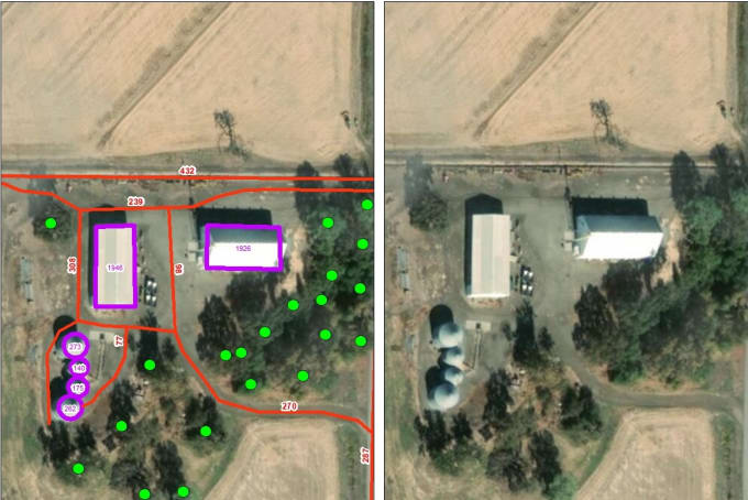
About:
Satellite imagery or aerial photography interpretation into GIS formats.- Imagery interpretation into kmz/kml/shp file.
- Based on open source imagery or any imagery you can provide.
- Classification of different features based on your needs.
- Creating Points, Lines and Polygons, based on the imagery.
- Area or Length measurement.
- And much more...
Kindly contact me before placing your order
Reviews
:
I chose to work with Sermal because he was able to understand my complex requirements very quickly. Even better, he proved to be able to execute on his understanding of the project and deliver excellent results in a quick time frame. His GIS knowledge is excellent. I will work with him again soon.
: : : :
No comments:
Post a Comment