I will do gis mapping, spatial analysis,cartography and remote sensing
About:
Do you want to visualize, analyze, and manipulate your data in the Geographic context or just want to understand spatial patterns and relationships, then GIS-based Analysis of your data is a must. We can discuss the possibilities that your scenario holds...
I have 6 years of experience in handling GIS-related tasks such as spatial analysis, remote sensing, Geoprocessing, and modeling etc.
I can help you in
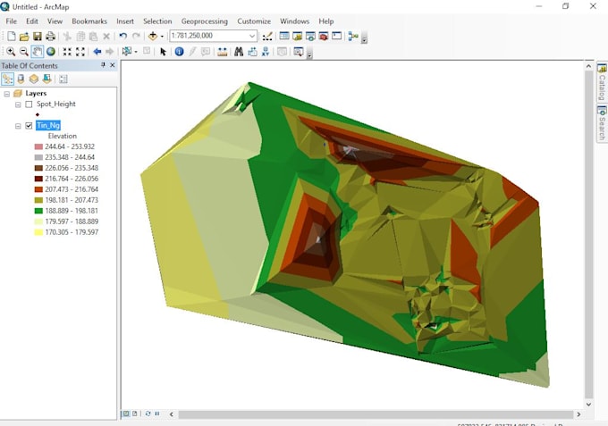
- Landuse/Landcover, Thematic, Climatic, Topographic mapping etc
- Terrain Analysis
- Drainage Analysis
- Digitization of data and base mapping
- projection and reprojection of Geographic Data
- Image Classification
- Suitability Modeling
- Cartographic Presentations/Maps
- Geodatabase Design and Management
- Routing/ Network Analysis
- GeoSpatial Modeling
- GeoStatistical Analysis
- Geoprocessing tasks and automation
- Web mapping
and much more...
For complex requests, custom orders are accepted.
· I can work on ArcGIS, QGIS, Erdas
· Also familiar with Python, Java,javascript Excel, and SPSS.
100% Money BACK Guarantee
Reviews
marklobanoff:Delivered as promised.
wequad:A leader indeed!
marklobanoff:Very helpful, flexible with working on a complex unique project
wequad:He is a doctor indeed, treat me like a king. Thanks for your support and believe
marklobanoff:Delivered as promised.
No comments:
Post a Comment